


Why are you here?
Why would someone dedicate themselves to the meticulous documentation of historic buildings using LiDAR laser technology? This choice is a testament to a person's deep values and noble character. It reflects the role of an individual who views themselves not merely as an owner but as a custodian of a treasured legacy. These stewards possess an intrinsic respect for the past and a heartfelt concern for the legacy they will leave for future generations. Through the precise documentation of these timeless structures, as they currently exist, they ensure that our shared history is eloquently communicated across the veil of time to those who will inherit this stewardship. Such foresight and wisdom highlight a profound commitment to preserving more than just architecture; it's about safeguarding the spirit of our collective heritage, making it accessible for future generations to explore, cherish, and learn. This endeavor is far more than a project—it's a bridge spanning the gap between our ancestors and our descendants, securing a tangible connection to our shared past.

Precise Documentation
Exceptional Accuracy: Achieves an impressive accuracy of up to 6mm (1/4”), ensuring detailed and precise measurements for a wide range of applications.
Vast Data Collection Capacity: At its most detailed setting, capable of capturing approximately 10,323 points per square foot, ensuring comprehensive coverage of surfaces and structures. We take the time to do a detailed scan. As the distance to the target decreases, the density of the data collection increases, doubling the resolution when the scanning distance is halved, revealing even finer details.
Efficient Processing and Compatibility: Designed to integrate seamlessly with leading processing and visualization software, supporting efficient workflow from data capture to final model.
Versatility in Use: Ideal for a broad spectrum of projects including architectural documentation, construction management, historic preservation, and more, thanks to its adaptability in capturing high-fidelity 3D data.


How does it work?
-
When the scanner is powered on, it performs a series of self-checks to ensure all systems are functioning correctly. The user can select the desired scan settings, such as resolution and scan area, through an interface.
-
The device emits a laser that measures 360,000 points per second, 360 degrees horizontally, and 270 degrees vertically. This laser, invisible to the naked eye, is precisely controlled to sweep across the target area systematically.
-
As the laser hits a surface, part of the light is reflected back to the scanner. The device measures the time it takes for the light to return, known as "time of flight," with incredibly high precision. This time is directly related to the distance between the scanner and the surface points it hits.
-
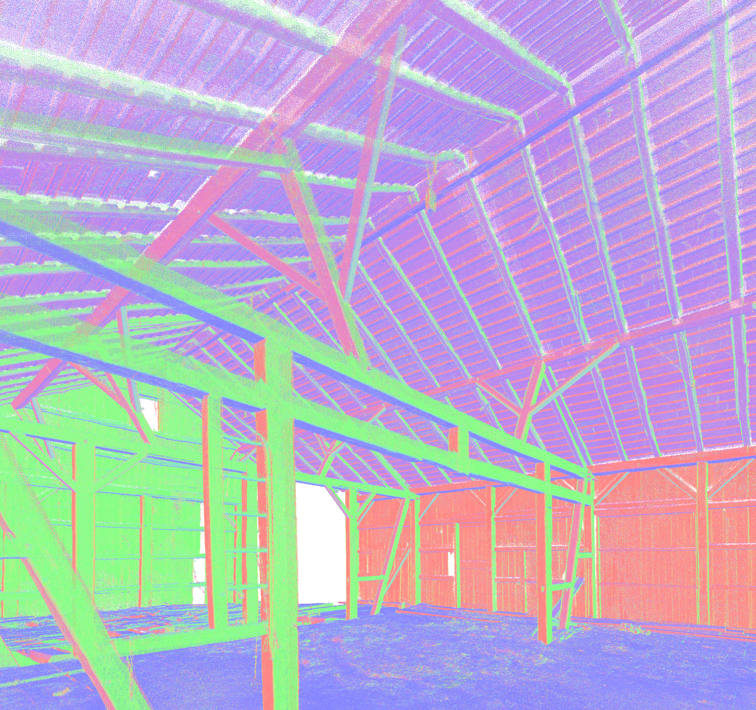
Each measured point's distance data, along with its angular position relative to the scanner, is used to calculate its exact location in three-dimensional space. Collectively, these points form a "point cloud" that represents the scanned area's geometry.
-
Our scanner also includes cameras that capture photographic images of the scan area. These images can be overlaid on the point cloud to create a photorealistic 3D model, providing texture and color information in addition to the structural data.
-
The raw data collected by the scanner is processed, to remove any noise or irrelevant points (like from moving objects). We align (register) multiple scans from different positions to create a cohesive model of larger areas or objects.
-
Once processed, the point cloud (and any associated images) can be exported to various software applications for further analysis, modeling, or integration into project workflows. This can include CAD (Computer-Aided Design) applications, BIM (Building Information Modeling) software, or VR (Virtual Reality) environments.
-
In external software, further refinements can be made, such as mesh generation (creating a solid model from the point cloud), detailed measurements, or virtual tours.
This process allows for extremely detailed and accurate documentation of physical spaces and objects. It is perfectly suited to documenting valuable and historic structures. The capability to capture the world in 3D with such precision is a powerful tool.
We use the data collected from the LiDAR laser scan to create a detailed and accurate 3D model of the frame which can be used to create drawings for repair, replication, or restoration.


